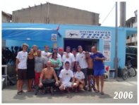
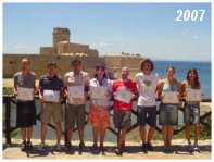
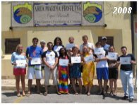
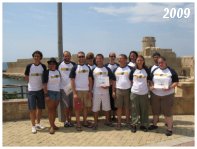
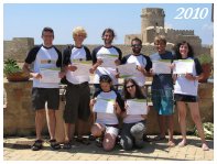
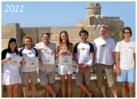
Le nazionalità dei partecipanti dell'edizioni precedenti:
![]()
![]()
![]()
![]()
![]()
![]()
![]()
![]()
![]()
![]()
![]()
![]()
![]()
![]()
![]()
![]()
![]()
![]()
![]()
![]()
![]()
Benvenuti al corso Dive GIS nell’area Marina Protetta di Capo Rizzuto ricca di storia! Qui avrete l’opportunità di diventare un esperto in sistemi informativi geografici ed un sub certificato! Immergetevi nel corso “Introduzione ad ArcGIS 10” e nei corsi di diving della PADI, i più famosi programmi al mondo nel loro campo! Il corso offrirà in aggiunta un modulo di sovrapposizione per introdurre i partecipanti alle metodologie e tecniche GIS utilizzate dai ricercatori in campo marino con delle sessioni in immersione ed al computer. Apprenderete come realizzare delle mappe degli habitat marini a partire da immagini satellitari, a verificare il lavoro sul campo, a eseguire dei rilevamenti della fauna e flora marina e trovare le associazioni tra tutti gli elementi biotici ed abiotici usando i GIS.
DOVE
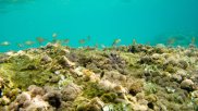
Il colore del mare passa dal tenue blu del cielo al verde smeraldo e la costa è veramente spettacolare, talmente ricca di storia e natura incontaminata da essere stata nominata il 27 dicembre 1991 “Area Marina Protetta” (AMP). L’ Area Marina Protetta di Capo Rizzuto si estende per 15.000 ettari nel mare ed è la più vasta in Italia. E’ lunga 36 chilometri e localizzata lungo la costa sud di Crotone, tra Capo Donato e Barco Vercillo, per una profondità di 100 metri verso il mare aperto. Vi è una vastità di ambienti marini che includono aree sabbiose, rocciose ed argillose e praterie di Posidonie che si rispecchiano in una varietà di colorate donzelle pavonine, nei mosaici delle spugne ed i vari echinodermi, crostacei, anellidi e nudibranchi. Nell’Area Marina Protetta si stagliano numerosi capi (promontori). Il primo è “Capocolonna” un sito ricco in archeologia, simbolo dell’era gloriosa della Magna Grecia. Qui si trova l’ultima colonna dorica del famoso tempio dedicato alla divinità di Hera Lacinia. Lungo la costa è facilmente raggiungibile la punta di “Le Castella”, l’ultima fortezza dell’era bizantina: la vecchia fortezza sull’isolotto dove nacque “Ugurk-ali” ammiraglio dell’armata navale imperiale di Costantinopoli.
Introduzione ad ArcGIS 10
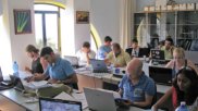
Questo corso fornisce i concetti fondamentali dei GIS e le conoscenze necessarie per svolgere query su un database GIS, manipolare dati tabellari, creare e editare dati geografici e attributi, e a presentare i risultati in modo efficace tramite mappe e grafici. I partecipanti imparano ad utilizzare ArcMap™, ArcCatalog™, e ArcToolbox™ e scoprono come queste applicazioni lavorano insieme per fornire un completo sistema informativo geografico. Cliccare qui per visionare il programma dettagliato.
GIS e telerilevamento applicati all'ambiente marino
Questo modulo affronta i concetti fondamentali del telerilevamento e fornisce le conoscenze necessarie a utilizzare tale tecnologia nella mappatura delle risorse marine. Il corso presenta una descrizione dei vari metodi di analisi e classificazione di immagini telerilevate e un approfondito caso di studio reale e pratico in cui i partecipanti mapperanno gli habitat della riserva marina mediante interpretazione visiva delle immagini telerilevate. Cliccare qui per visionare il programma dettagliato.
Corso PADI di immersione subacquea
I corsi PADI sono il biglietto da visita per tutta una serie di nuove e fantastiche esperienze subacquee. PADI è lo standard internazionale più diffuso. Scoprite questo mondo con il corso Open Water o migliorate le vostre conoscenze e capacità subacquee con il corso Advanced Open Water o la specialità "Massima Esecuzione dell'Assetto".
Marine Fauna identification and data collection on the field
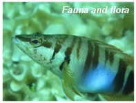
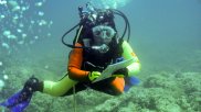
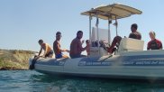
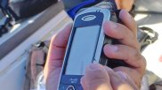
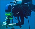
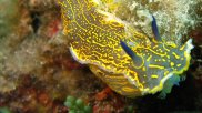
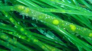
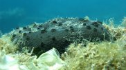
Gli studenti apprenderanno come identificare la fauna e flora marina, come raccogliere dati scientifici riguardo la loro distribuzione e come utlizzare unità GPS e sistemi GIS su palmare. I partecipanti raccoglieranno anche dati di habitat per la verifica e la stima dell'accuratezza dell'interpretazione visiva delle immagini telerilevate. I dati saranno raccolti sul campo, immergendosi con le bombole o facendo snorkeling. Visitate la galleria fotografica della flora e fauna di Dive GIS
Corsi di specialità PADI Project AWARE
Il Progetto Aware rappresenta l'impegno della PADI a evidenziare il ruolo fondamentale dei subacquei nella protezione degli ambienti marini. Durante il corso i partecipanti potranno ottenere i brevetti di specialità del progetto AWARE incluso i corsi "Fish Identification" e " Project AWARE " il cui scopo è quello di fornire al subacqueo la conoscenza dell'ecosistema acquatico marino e delle misure necessarie da intraprendere per la sua difesa e la sua tutela.
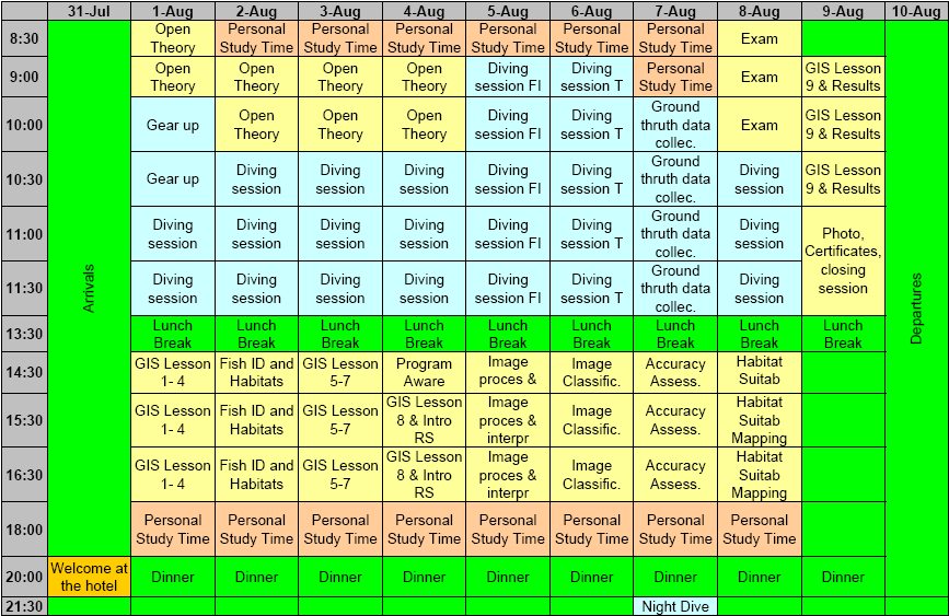
PROGRAMMA GIORNALIERO
Il programma giornaliero può subire grandi variazioni in base ad una serie di fattori tra cui le condizioni meteorologiche, ma vi invitiamo a visionarne un esempio:
ALLOGGIO, VITTO e TRASPORTO
I partecipanti saranno ospitati in camere doppie o triple con servizi, in un accogliente hotel con pensione completa (pranzo al sacco e cena completa)
Le strutture del corso (alloggio, diving e aula didattica) si trovano ad una distanza di circa 10-15 minuti di cammino le une dalle altre (1000 metri). Chi desiderasse un mezzo di trasporto può rivolgersi autonomamente agli autonoleggi del posto.
COSTO
Il costo include:
*Coloro che non richiederanno una certificazione PADI avranno diritto ad una riduzione del costo di 120 Euro. Restano incluse 10 immersioni a carattere scientifico.
Costo totale di iscrizione:
Entro il 31 Dicembre 2010:Euro 2100 + VAT
Entro il 31 Marzo 2011: Euro 2300 + VAT
Entro il 31 Maggio 2011: Euro 2500 + VAT
I posti per questo corso sono limitati e verranno assegnati solo dopo il versamento di un anticipo non restituibile di 500 euro. Le iscrizioni si chiudono il 31 Maggio 2011.
COME RAGGIUNGERCI
Il modo migliore per raggiungere Crotone è prendere un volo per l'aeroporto di S. Anna. Le compagnie aeree che volano su Crotone sono l'Alitalia (da Milano e Roma) e la Danube Wings (da Bologna). In alternativa è possibile raggiungere Crotone in treno o in autobus. Il pick up e drop off saranno forniti per l'aeroporto, la stazione dei treni o dei pullman di Crotone nelle date di inizio e fine corso.
ISCRIZIONE
Le iscrizioni sono effettuante compilando e inoltrando il modulo di iscrizione online.I dettagli per il pagamento mediante bonifico bancario sono forniti dopo l'invio del modulo.
Se intendete iscrivere un gruppo di persone contattateci per conoscere le opportunità disponibili.
Il corso sarà svolto principalmente in inglese ma gli studenti saranno seguiti da vicino da istruttori italiani.
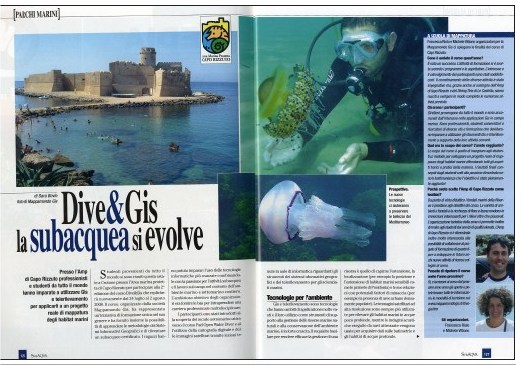
Leggete l'articolo su Dive GIS di Subaqva, rivista specializzata
in subacquea:
"Dive GIS, la subacquea si evolve"
nel numero di Novembre 2007:
www.subaqva.com
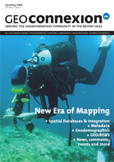
Articolo su Dive GIS pubblicato sulla nota rivista Geoconnexion: "New Era of mapping", edizione Aprile/Maggio 2008. Siamo in copertina!
REVIEWS
Ecco cosa dicono di Dive GIS i partecipanti delle edizioni precedenti !

Montse, GIS Manager, Mexico
Come mai ti sei iscritta al corso?
Lavoro utilizzando i GIS in materia di conservazione ambientale e aree marine protette. É molto importante per il mio lavoro essere a conoscenza delle applicazioni GIS all’ambiente marino. Molti colleghi del mio dipartimento hanno cercato per molto tempo corsi su questa materia e non hanno mai trovato nulla. In seguito siamo venuti a conoscenza del corso Dive GIS e ci siamo accorti che si trattavava esattamente del corso che stavamo cercando: applicazione dei GIS in ambito marino, lavoro sul campo e miglioramento delle capacità subacquee.
Pensi sia stato utile frequentarlo?
Tantissimo, ne sono convinta. Avendo raggiunto un livello superiore nella certificazione PADI mi sento più sicura quando faccio immersione (sia per lavoro che per puro divertimento). La combinazione del corso PADI con il lavoro sul campo mi ha dato la possibilità di testare le nuove capacità che stavo acquisendo. Allo stesso tempo, conoscere il nuovo software ArcGIS 9.2 è stato molto utile. Ogni nuova versione del software ArcGIS presenta numerose novità, e poter prender parte a un corso così pratico è stato il modo migliore per assicurarmi le conoscenze necessarie ad utilizzare il software al pieno delle sue possibilità. Imparare svariati concetti del telerilevamento applicati all’ambiente marino è stato molto interessante e sarà molto utile al mio lavoro.
Cosa hai imparato durante il corso?
Ho acquisito molte nuove abilità subacquee e sicurezza nelle immersioni. Ho imparato a utlizzare i numerosi strumenti disponibli in ArcGIS 9.2 insieme a svariati “trucchi” che riducono significativamente il tempo necessario a svolgere diversi compiti e procedure. Ho acquisito conoscenze sui principi basilari del telerilevamento, sui diversi tipi di sensore, sui modelli d’idoneità degli habitat e molto, molto altro. Ho anche imparato numerose parole in italiano!
Cosa hai apprezzato di più? Perché?
Ci sono tantissime cose che mi sono piaciute in modo particolare. Gli istruttori sono stati ottimi ed erano chiaramente esperti delle materie trattate. La sede del corso e il centro d’immersione sono stati meravigliosi. Ma sopra ogni cosa, la possibilità di svolgere esercitazioni utilizzando dati reali da noi raccolti, contrapposto a lezioni puramete teoriche, è stata grandiosa. Anche avere avuto l’opportunità di interagire con persone provenienti da diverse parti del mondo che lavorano su argomenti simili è stato stupendo. É stata un’utile e fantastica esperienza.
Pat, GIS Engineer, United Kingdom
Come mai ti sei iscritto al corso?
Non ho trovato nessun altro corso che offrisse un’applicazione dei GIS così approfondita e pratica. Con il corso “Dive Gis” ho acquisito valide conoscenze GIS sul campo e su come questa tecnologia possa essere applicata negli obiettivi della gestione delle risorse marine. Tutto ciò, in combinazione con lezioni tenute da esperti d’immersione subacquea, era proprio quello che cercavo in un corso applicato di GIS.
Pensi sia stato utile frequentarlo?
Non solo ho appreso molto su come i GIS possono essere utilizzati nel campo della gestione delle risorse marine e della conservazione, ma ho anche compreso l’importanza e l’efficacia dell’uso di tale strumento per questo tipo di progetti.. Il corso mi ha insegnato moltissime tecniche che ora posso impiegare nel mio lavoro di tutti i giorni.
Cosa hai imparato durante il corso?
Ho imparato molto sulle techniche del telerilevamento nei rilevamenti marini e come si possano elaborare le immagini satellitare per ottenere delle mappedei fondali marini. Ho inoltre acquisito conoscenze sugli habitat marini e sulle techniche per l’identificazione di flora e fauna.
Cosa hai apprezzato di più? Perché?
Quello che ho apprezzato tanto è stata la varietà delle attività e dei contenuti offerte dal corso. Dal diving, all’identificazione degli habitat e dei pesci, alle lezioni in classe dove abbiamo unito insieme i vari elemnti didattici e appreso le potenzialità dell’uso dei GIS in campo marino. C’è stato un’ottima proporzione tra parti teoriche e pratiche e tutti gli argomenti trattati e le prove sul campo adempivano agli obiettivi del corso in modo perfetto.

"This course could be described as the perfect experience for divers who are into GIS (or also non divers, who will fall for it by the end of the course!). Being able to do GIS and learn diving skills is GREAT! Thank you for taking the time to design the course, and organizing everything to achieve such levels of perfection!!!"
Fabio, Venezuela
"I really enjoyed the course. I was comparatively new to diving and was taken through the PADI course by an excellent instructor. Conversely I am experienced in GIS, but was given scope by the GIS lecturer to explore other datasets and advanced techniques. I found the Remote Sensing aspects of the course stimulating, and I look forward to integrating material on Mappomondo GIS' activities into my own lecturing courses at University. The hotel and owners were exceptional, I really couldn't commend them enough. Le Castella (Crotone) is a beautiful part of Italy and offers superb diving opportunities. This combined with the wealth of biodiversity interest in this region of the Mediterranean makes it a superb location."
Niall, United Kingdom

"I have learned a lot on this course and the people who put this all together take care of everything in order to make this a stress free and enjoyable experience. The entire crew of MappamondoGIS were extremely friendly and highly skilled with what they do. I feel so comfortable as a diver now thanks to my instructor :) Everyone has just been amazing and made this experience a trip of a lifetime."
Stephanie, USA

"The course has been beautiful and in my opinion of high quality. Obviously the time hasn't a lot but I have been surprised for the management of the course and for the hospitality of the people. At the end I can say that the course has overpassed every expectation that I have had at the beginning. I would be so happy to do another dive course here the next year."
Lorenzo, Italy

"The course offers a unique blend of marine GIS, field work and scuba learning. It is very useful for people interested in marine conservation and management of MPAs. Working with people from all over the world is a great opportunity for networking. Congratulations for developing an original, useful, interesting and pleasant course!"
Dragos, Romania

"I was very pleased with this course, and it was an excellent experience. Thank you very much!! The course took all my money savings, but I am so happy I spent my money in such a good way :)"
Laura, Germany
"The contents of the course were very satisfactory for my study. I always looked for a course where I can improve the use of GIS applied to marine environment like DIVE-GIS. The course was very interesting. I think it was perfect for someone who wants to improve his knowledge of GIS applied to marine habitat like me. Moreover it offers to you the possibility to take a dive certification diving in wonderful place with instructors very careful and patient and to improve your English. The number of the participants was right for this kind of course."
Danilo, Italy

"The Dive GIS course is more than just a training course with a unique combination of content. Besides being a wonderful learning experience, the course was made more special by the efforts, warmth and hospitality extended by our hosts and sponsors. As a marine researcher, the course gave me a great opportunity to interact with people from different parts of the world who are involved with wildlife research and also meet people from very different professional backgrounds who all share a common love for the sea and of course also a passion for scuba diving."
Sruthi, India

"I have learned a lot during this course and I look forward to apply this knowledge. It was a pleasure for me to meet our really good instructors in a so unique course like the Dive GIS. I also would like to say thanks for all the participants making this course unforgettable."
David, Hungary
The hospitality was wonderful. The people were very friendly and helpful in the hotel, at the dive center and at the courses as well. They helped us a lot to have a great time at Dive GIS Course in Le Castella. Thank you for organizing this kind of course, it was a pleasure to participate to this course. Congratulation for the organizers! :)
Anita, Hungary
"The contents were really interesting for me, I have learned a lot more on GIS and the georeferencing data part was all new for me. I got a lot of new ideas on how to use collected datas and discovered different interesting ArcGIS extensions and software for ecological elaborations. This course is very useful to learn more (or to introduce yourself) on GIS and remote sensing. The teachers are very good and the place is very pretty and enjoyable with very nice dives."
Cecilia, Italy

"Great and innovative course. It's been a sum of new and fun underwater adventures and interesting lessons to improve my ArcGIS and Remote Sensing knowledge mapping marine habitats. The instructors have been very competent and patient and I've known guys from all over the world! Many thanks to all of you for this wonderful experience!"
Nina, Norway
"The course is organised very well, everything is set up and worked without flaws. Diving in the morning and class in the afternoon is a good way of learning both the theory and practical aspects of marine mapping. Both class and diving lessons were well organised to suit all levels of expertise. I learnt a lot from this course about GIS as well as diving and marine habitats and species...I felt very welcome here, everyone was very kind and wanted to make sure I had everything I needed."
Pat, United Kingdom

"I enjoyed this course very much. It was very interesting to meet people who work with GIS at other places in the world. The marine habitat information was very interesting. The location and the dive shop are wonderful! The hotel had a perfect location, the room was nice, the food was nice, very friendly."
Montse, Mexico

"Very glad I came and congratulations on developing a much-needed product."
Tamsen, New Zealand
"Il corso mi ha soddisfatto, vi devo fare i COMPLIMENTI,soprattutto per la passione e per la pazienza."
Max, Italy
"Ho trovato il corso ben organizzato e sufficientemente sviluppato in tutti i suoi punti"
Frine, Italy
"The course is well designed for studying coastal natural resources conservation and management using combined approaches of remote sensing and GIS techniques."
Vijay, India
"Dive GIS was a wonderful experience a full immersion practical and theoretical. Very useful especially for my thesis project with aim to mapping and monitoring the flora in the Gulf of Naples. Le Castelle is very nice place, the marine protected area is a magic world to discover and full of surprise"
Alessio, Italy
"I really enojoyed taking part in this course and the area was the perfect setting. The course was both relaxed and informative and i have learned a lot of new skills. The diving element to the course was enjoyable, and was useful for learning how the theory we studied was produced in the field. Thanks for a great time!"
Gemma, Scotland
"It was a lot of fun, I got what I expected regarding new knowledge/skill, I met some interestig people, visited area I have never been before and I'm satisfied!"
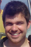
Andrej, Croatia
"I really enjoyed this class. It's a great introduction for those who are new to GIS and/or new to scuba diving. All of the instructors were helpful, informative, and answered any and all questions we had. The location is beautiful and being able to look out our classroom window at a castle made the class even more exciting. I would recommend this program to anyone who wants to expand their knowledge of GIS/SCUBA and enjoys the outdoors. "
Michael, USA

"Taking this course in a Marine Protected Area make the course very attractive and gave us the perspective of the importance to use the technology for marine survey, implement conservation and managing strategies."
Deborah, Puerto Rico
"I thoroughly enjoyed this class and learned a lot in only 10 days. I would recommend this course to others seeking a unique combination of diving and GIS experience. Thank you for teaching this class and taking the time necessary to put it together. "
Joshua, USA
"It was a great course, a wonderful place to stay and dive, and I was happy to see the connection between what I have been studying with GIS and applying it to real world data collection and analysis! "
Morgan, USA
"I really enjoyed my whole experience and I am so glad that Mappamondo GIS created this opportunity for me. "
Margaret, USA
"DiveGIS is a great introduction to both scuba diving and the intergration of the marine environment into ArcGIS. The teachers are extremely knowledgeable, the area is beautiful for diving and I don't think you can find a similar program in the world that combines the fun of diving and the education of marine GIS in such a short period of time. I would recommend it for anyone looking to learn more about marine GIS. "
William, USA
"I think the course is an excellent idea and I would recommend it to anyone interested in the area."
Sarah, UK

"It was a wonderful experience to go and collect the data in the field and to use it in the GIS course."
Jens, Belgium

"Pure love for the field of Marine research and devotion to sciences in general by the organisers of the course lead to an excellently organised and delivered course. A highly recommended course to anyone interested in the fields of diving, GIS and remote sensing from amateurs to professionals."
Louis, Cyprus
LINKS

Monitoraggio ambientale
Scrivi a info@mappamondogis.com per domande o commenti su questo sito.
Copyright © 2005-2010 Mappamondo GIS
VAT 02375720345 - Ph +39 02 899 26 8 26
![]()
![]()