Geographic Information Systems and IT solutions for the environment
Geographic Information Systems and IT solutions for the environment
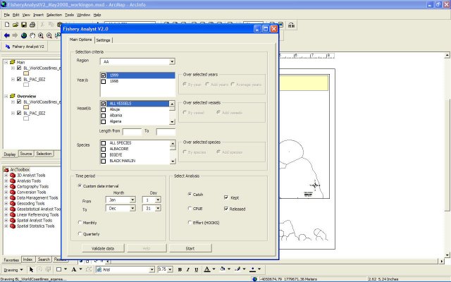
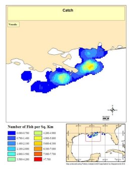
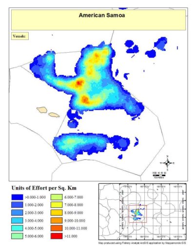
Fishery Analyst is an ArcGIS 9.x and 10 application developed to effectively analyze and visualize temporal and spatial patterns of fishery dynamics. The main functions are quantitative estimation and visualization of catch and effort and their variation in space and time, analysis of fishing vessel utilization, data quality control, and deriving information on the location of important economic and threatened species. The application provides a user-friendly analysis interface allowing for easy and diverse output production. The interface allows the user to choose the analysis to perform (effort, catch density, catch per unit of effort etc) and to select data on criteria such as year, vessel name and/or size, and fish species caught. The output can be generated as yearly, monthly, quarterly or user-defined date interval plots. Results can be plotted in pre-defined map layouts and saved in quantitative GIS data file formats (raster and vector) or as graphic files and times series animations. The application provides an option to produce non-confidential plots for data protected by confidentiality policies.
![]()
![]()
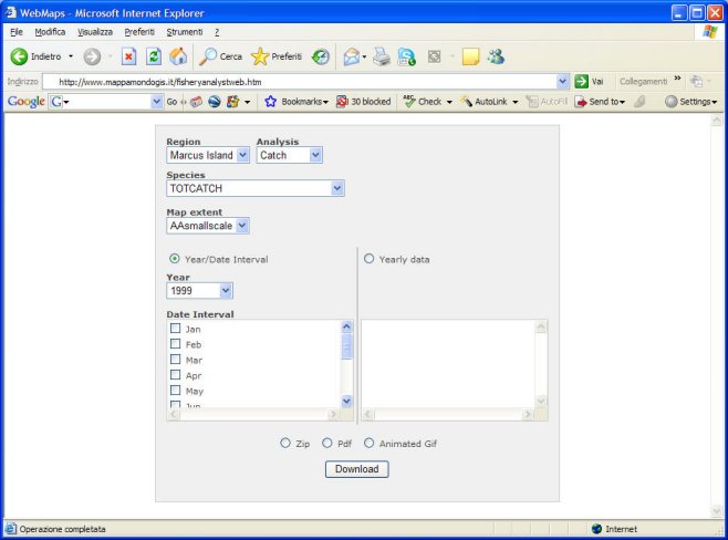
The web component allows to easily serve pre-made plots over the web as animations or single graphic files by offering to the users a friendly and immediate searching and animation building interface.
Watch a video presentation of Fishery Analyst capabilities
held during an Ecosystem Based Management Tools network
webinar and feel free to
download the pdf version
of it:
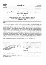
Download the user manual or request us the peer reviewed article "A Geographic Information system for fisheries management in American Samoa" (author Francesca Riolo) published on the journal Environmental Modelling & Software, Volume 21, Issue 7, July 2006, Pages 1025-1041.:

ESRI Germany featured Fishery Analyst case studies in the article "The case of Pacific Islands Fishery Science Centre" on the GIS magazine "arcAKTUELL" 1/2011 (page 26).
ESRI Switzerland presented "The case of Porto Cesareo Marine Protected Area" on its case studies series.

The Pacific Islands Fisheries Science Center/ NOAA Fisheries - Hawaii
The Pacific Islands Fisheries Science Center of the National Marine Fisheries Service (NMFS) is part of the National Oceanic and Atmospheric Administration (NOAA). The Center administers scientific research and monitoring programs that support the domestic and international conservation and management of living marine resources. The Fisheries Monitoring and Socioeconomics Division (FMSD) consists of four distinct programs that conduct a wide variety of fisheries monitoring and research in the Pacific Islands Region and surrounding international waters. FMSD's mission is to provide the best available fisheries-dependent data, fishery reporting, technical support, social and economic research, and advice in support of federal fisheries management in the central and western Pacific. The data collected, processed, compiled, analyzed, and provided by FMSD make up a substantial fraction of the foundational fishery statistics and information needed by fishery scientists and managers in the Pacific Islands Region.
Gulf of Mexico Branch of the Sustainable Fisheries Division, Southeast Regional Office, National Marine Fisheries Service (NMFS) - USA
The Sustainable Fisheries Division, Southeast Regional Office, National Marine Fisheries Service (NMFS), is entrusted with the conservation, management, and protection of marine fishery resources inhabiting federal waters off the southeastern United States from North Carolina through Texas and Puerto Rico and the U.S. Virgin Islands. The Division is the Region’s focal point for implementing NMFS' primary legislative authority for fisheries management and research, the Magnuson-Stevens Fishery Conservation and Management Act (Magnuson-Stevens Act), as amended by the Sustainable Fisheries Act (SFA). The Division works directly with the Region’s three fishery management councils established by Congress to perform the mandates of the Magnuson-Stevens Act. These mandates are accomplished through fishery management plans for marine finfish and invertebrates that support important commercial and recreational fisheries in the Gulf of Mexico, South Atlantic, and Caribbean and consider conservation and management issues, sociological and economic issues, and regulatory issues. The Gulf of Mexico branch is using Fishery Analyst to analyse catch and effort data on red snapper, shrimp, reef fish and spiny lobsters fisheries.
Department of Marine and Wildlife Resources - American Samoa
The American Samoa Department of Marine and Wildlife Resources (DMWR), formerly the Office of Marine Resources, located in Pago Pago on Tutuila, has been collecting commercial fisheries data from the local fleet on Tutuila since the early 1970's and from the Manu'a Islands since 1983. Most data collected over the years have been from the commercial fleet, but beginning in October 1985, DMWR's data collection programs were modified to include data on recreational and subsistence fisheries as well. The Department is using Fishery Analyst to produce plots on the spatial distribution of commercial longline fishery over the years.
Miscellaneous
Email info@mappamondogis.com with questions or comments about this web site.
Copyright © 2005-2010 Mappamondo GIS
VAT 02375720345 - Ph +39 02 899 26 8 26
![]()
![]()