Geographic Information Systems and IT solutions for the environment
Geographic Information Systems and IT solutions for the environment
Welcome to our project gallery. These are just some examples of the projects and clients we are involved with.
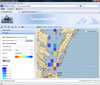
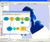
Fishery Analyst Online
Clients:
Keywords: web GIS application, fishery management, fishery analysis
Links: Fishery Analyst Online
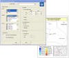
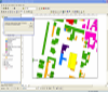
Fishery Analyst for ArcGIS Desktop
Clients:
Keywords: GIS application, fishery management, fishery analysis
Links: Fishery Analyst
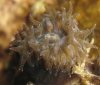
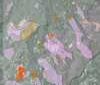
A survey of the Scleractinia corals within diving depths of Capo Rizzuto Marine Protected Area
Client: Capo Rizzuto Marine Protected Area- Italy
Keywords:
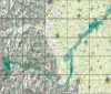
A Geographic Information System to monitor temporal and spatial dynamics of longline fishery catch and effort in the Pacific Ocean.
Client: NOAA Fisheries, Hawaii - USA
Keywords:
Links: Peer reviewd article in the journal Environmental Modelling & Software, Volume 21, Issue 7, July 2006, Pages 1025-1041. Please write us if you wish to receive a pdf of the paper.
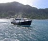
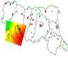
A geoprocessing model to estimate sightings success and abundance of bottlenose dolphins along Italy coastlines.
Client: Genova Aquarium - Italy
Keywords:
Development of a Geographic Information System for acoustic disturbances monitoring.
Client: Genesis, Parma - Italy
Keywords:
Development of an enterprise geodatabase and migration tools for corporate data
Client: Kadme, Stavanger - Norway
Keywords:
Enabling Modena Province Tourism Data Warehouse for web GIS data download for GPS navigation systems
Client: Modena Province- Italy
Keywords:
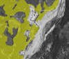
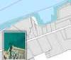
Updating of forest cover maps from high resolution aerial and satellite images.
Client: Modena Province- Italy
Keywords:
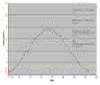
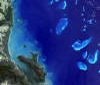
Using satellite derived SST data to monitor sea temperature in coastal areas of American Samoa.
Client:Department of Marine and Wildlife - American Samoa
Description: This project...
Optimizing Sea Surface Temperature AVHRR satellite data interpolation using the time variable
Client:James Cook University - Australia
Keywords:
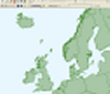
Caribbean Environmental Monitoring Database
Client: NOAA NURP - The Bahamas
Keywords:

A database for Caves and Karsts in The Bahamas
Client: Bahamas Cave Foundation, Florida - USA
Keywords:
Telemetry tracking marine fauna and benthic surveys geodatabases.
Client: Caribbean Marine Research Institute - The Bahamas
Keywords:
Great Barrier Reef wide mapping from Landsat ETM+ satellite data.
Client: Great Barrier Reef Marine Park - Australia
Keywords:
Cressi: Customized software for the census of industrial outfalls.
Client: Emilia Romagna Region - Italy
Keywords:
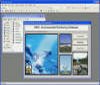
MapViewer: Software for geographic data visualization and query.
Client: GISForm, Parma - Italy
Keywords:
Maintenance and upgrading landslide WebGIS.
Client: Parma Province - Italy
Keywords:
A Geographic Information System for hydraulic works in the Po river
Client: Po Watershed Authority, Parma - Italy
Keywords:
A Geographic Information System to model atmospheric pollutants dispersion.
Client: Environmental Protection Agency, Italy
Keywords:
A Geographic Information System to track water pipelines in North Africa.
Client:...
Keywords:

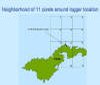
Map of birds fauna and protected areas in the Friuli Venezia Giulia Region.
Client: Italian birds fauna Protection Agency
Keywords:
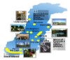
Miscellaneous
Email info@mappamondogis.com with questions or comments about this web site.
Copyright © 2005-2010 Mappamondo GIS
VAT 02375720345 - Ph +39 02 899 26 8 26
![]()
![]()